Arkansas Tornado Threat Today 3/13/2016
Today looks to be a significant day for severe weather and tornadoes in Arkansas. The Storm Prediction Center has issued an “Enhanced Risk” for severe storms and tornadoes today in Arkansas, as well as in parts of northern Louisiana and eastern Oklahoma
There is already a tornado warning located in Southwestern Arkansas. Tornado Watches have been issued for eastern Oklahoma and for Arkansas. People living in Little Rock and surrounding areas in Arkansas need to be monitoring changing weather conditions and stay tuned to local TV/Radio/NWS for tornado warnings.

Eastern Oklahoma is also under a Tornado Watch


Given the high amounts of instability coupled with the cold temperatures aloft, large hail is a threat as well.

The most recent change in the SPC outlook is the inclusion of a higher tornado probability.
“A SIGNIFICANT TORNADO RISK AREA HAS BEEN INCLUDED” – SPC


If you haven’t already, make sure to have your tornado sheltering plan in place! Charge your batteries on your NOAA weather radios and stay tuned to local tv/ radio stations for weather alerts.
Reminder: a Tornado Watch means conditions are favorable for tornadoes to form, Tornado Warning means a tornado is occurring and to seek shelter immediately!
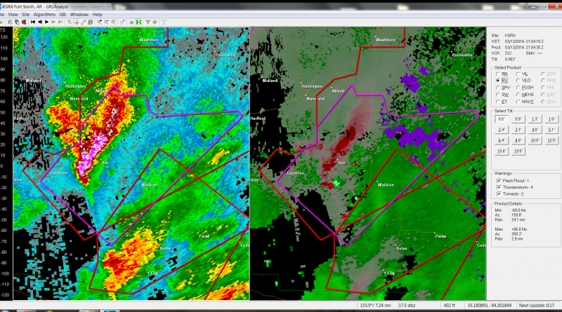
As of writing this, there is an tornado near Hon and Waldron, Arkansas:

If you are under a tornado warning- seek shelter immediately!
Stay safe!
