Snowstorm & Blizzard Conditions 2/1 – 2/3
Conditions are coming together for a major snowstorm to affect the Colorado Front Range (thanks to ‘upslope’), heavy snow in central KS and a blizzard in parts of Nebraska, Iowa and into Wisconsin. Here are the current watches and warnings issued by the NWS for this system:

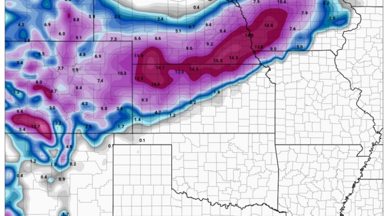
Total Accumulated Snowfall per the 18z NAM at a 10-1 ratio (meaning: every inch of water would equal 10 in snow)

Here’s the 18z run of the GFS by noon Tuesday:

The more recent model runs have been lessening the total snowfall (earlier runs show the Denver area getting over 12+ in) however, the models are still in agreement with heavy snow in the Denver metro and blizzard conditions will exist from south central Nebraska northeastward through Iowa.
The official NWS definition of a ‘Blizzard” is:
“A blizzard means that the following conditions are expected to prevail for a period of 3 hours or longer:
Sustained wind or frequent gusts to 35 miles an hour or greater; and
Considerable falling and/or blowing snow (i.e., reducing visibility frequently to less than 1/4 mile) ”
NWS of Hastings, Nebraska has a really good graphic they shared about being prepared for a blizzard:

Here’s another good guide from NWS about safety:

Stay safe and drive for the conditions!
– Colt Forney
Follow Colt on Twitter! @Basehunters_Colt
